hbus.ca and thoughts about crowdsourcing
Mar 25th, 2009

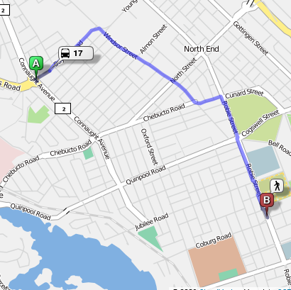
So I opened up my baby, hbus.ca, to the public last week (though traffic only really started to pick up yesterday, after a positive article in the daily news). This site, a trip planner for the Halifax Regional Municipality, was the cumulation of about 6 months of part time work on my part, between contracts for my awesome company, Navarra.
I’m debating on whether or not to start a seperate blog for hbus. At the moment I’m leaning towards no: my thinking is that most people don’t care about the inner workings of a site like hbus. They just want to figure out how to get from point A to B. Those who do care can read the rest of what I (and my part time co-conspirator, Peter McCurdy) have to say.
The most glaring limitation in hbus right now is that its route coverage is woefully limited. Trips on the main Halifax peninsula are generally planned pretty effectively. If you’re travelling to a suburban area like Bayer’s Lake or Burnside, not so much (unless you’re lucky enough to be starting/ending near a bus timepoint). What is to be done?
A frequent suggestion I get from more technically minded folks is that I should “crowd source” the missing information. This basically implies creating a wikipedia-like architecture such that people could contribute their favourite stops, routes, etc.
It’s a tempting idea. Such sites as OpenStreetMap show that this approach can be very effective for gathering large amount of geographical data. I’m frankly not convinced it’s the right approach here though. The fact is that Metro Transit MUST have a complete set of stops, route schedules, and route plans internally. There’s no way they could plan their operations halfway effectively otherwise. Why should I burden the public with the task of recreating something which has already been done?
I may be crazy, but I think the best avenue for the moment is to try to convince Metro Transit that it would be worthwhile to make this information public. I paid for the generation of the information with my tax dollars, why shouldn’t I be able to make use of it? The preferred format for this information is Google Transit Data Feed, but I could make use of information in just about any representation (Arc GIS, etc.). Just give me what you have, and I’ll take of the rest. Over 20 of the most successful transit agencies in North America (many of them much bigger than Metro Transit) have opened up their information to the public, with only positive results.
The most obvious use of this information is a trip planner and, yes, I know every agency and their dog has (or will have) one of these. But maybe someone has a cool idea on how to make a trip planner easier to use (compare hbus.ca with Tous Azimuts). Or what about transit maps that help people figure out where to live? Or iPhone and Blackberry applications? Or cool screensavers? Or or or. The possibilities are truly endless once the data is out there. Come on Metro Transit, you have nothing to lose and the eternal love of your ridership to gain.